

Powerful storm system expected to impact Mid-Atlantic area bringing widespread heavy rain and significant flooding
- Lori Lee WGOLV

- Jan 8, 2024
- 1 min read
Another powerful storm system is expected to impact the the Mid-Atlantic area beginning during the middle to latter part of Tuesday and lasting Tuesday night into Wednesday, according to the National Weather Service.
This storm will produce widespread heavy rain and is expected to bring significant flooding, according to the NWS.

The Weather Prediction Center has issued a large area of slight and moderate risk for excessive
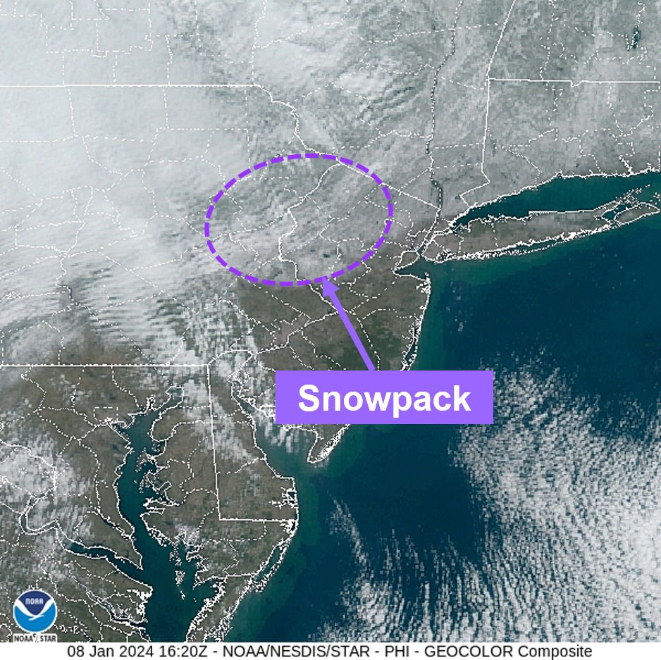
Satellite imagery today shows much of northern New Jersey, Poconos, and Lehigh Valley still have a bit of snowpack lingering from this weekend. - Unfortunately, this is not good news for our rainfall forecast Tuesday into Wednesday, as the snowpack will just become excess runoff in our rivers and streams, according to the NWS.
The National Weather Service expects widespread minor to moderate river flooding, with some locations reaching MAJOR flood stage, beginning Tuesday evening through at least Wednesday.

Along the coast winds could gust to over 60 mph! Gusts inland will likely be at least 40 to 50 mph. This could lead to numerous power outages.
For a briefing on this storm please see: https://www.weather.gov/media/phi/current_briefing.pdf
For more information on the significant river flooding threat, check out this link at the Mid-Atlantic River Forecast Center:
Find the latest river forecasts using the link below.
For further local forecast details, please visit weather.gov/phi.


